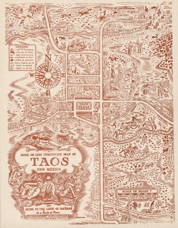
A More or Less Inaccurate Map of Taos, New Mexico
Cartographer:
Lockwood, Ward
Date of Creation:
c1940
A humorous map of the Taos region by a well-known artist of the Taos School, Ward Lockwood. Included is the area from Rancho de Taos to the Taos Pueblo. The title notes that the map is the “Guide to the Land of Manana in a State of Peace”
The scale of miles is a question mark [ “?”] as “Everything is out of Scale here”
A short history of Taos appears on the verso, noting the Town had been on the map for 400 years, which would date this item as 1940 or later. Lockwood was not a permanent resident by this time, so it is possible the maps dates from an earlier period.
