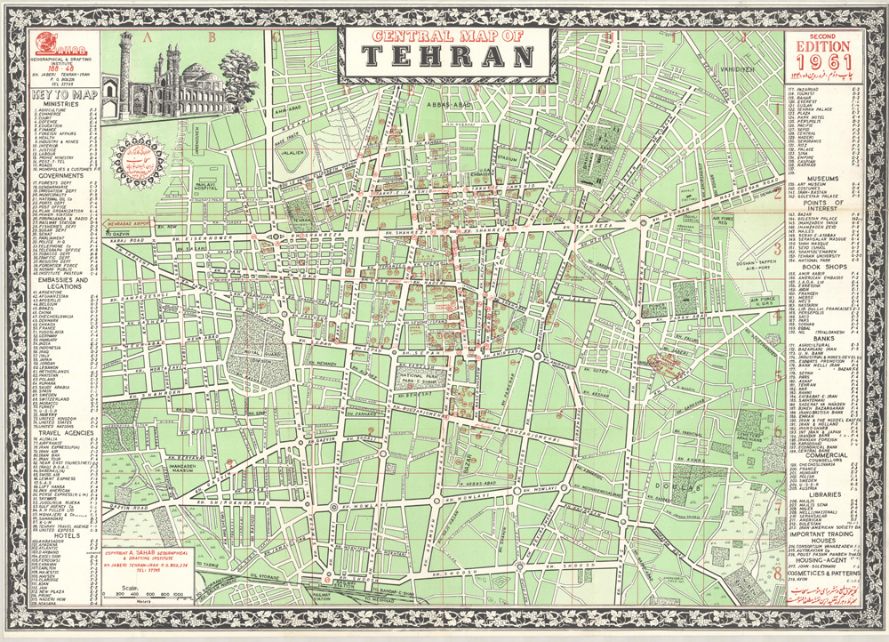
Central Map of Tehran
Cartographer:
Sahab, Addass
Date of Creation:
1961
A comprehensive plan of central Tehran, the Key identifies the locations of all the Government Ministries, embassies and legations, travel agencies, hotels, museums, bookshops, banks, libraries, “Important Trading Houses”, “Commercial Counsellors”, and “Cosmetics and Patterns” (ie Avon), also the Sahab Geographical and Drafting Institute, Air Force Headquarters, the Doshan-Tappeh Airport, and the Pahiavi Hospital.
The Sahab Geographic and Drafting Institute was founded in Tehran in 1935, the first private geographic and mapmaking enterprise in the Middle East, by Abolghasem Sahab. The firm was later run by his son Abbas Sahab.
Abbas Sahab is often called "Father of Iran’s Cartography". He was born in Fam, in Tafresh district in Iran. His father Ostad Abolghasem Sahab Tafreshi was a famous writer and author of about seventy titles on historical, geographical, religious, cultural and artistic topics. He devoted himself to cartography, and created more than 1,500 works including maps, atlases, plates, scientific and medical illustrations, as well as geographical globes. Sahab was a member of the International Cartographic Association (1968-1971), and in 1970 organised the First International Map Exhibition in the Tehran Teachers Training High School. In his last years, he dedicated himself to his monumental work ‘The Great Atlas of 14 Centuries of Islamic Arts’, published in 20 volumes, of which the first volume was appeared in 2000.
